Friday, August 29, 2014

Bicycle Touring North Georgia


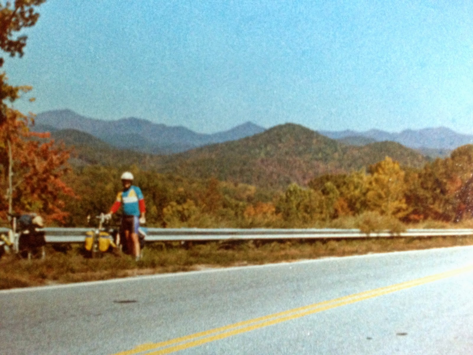
Bill Dion with north Georgia's War Woman Dell in the background
In the years I lived and worked in Chattanooga, TN, I discovered northern Georgia as my favorite destination for backpacking, canoeing, camping and bicycling.  The busy four-lane highways had not yet been built and the small towns and beautiful country was just waiting to be discovered.  It still retains a lot of that charm and I highly recommend you go see for yourself.  Check out the spring and fall festivals throughout the area.
A few years later my friend Bill Dion and I cooked up some bicycle tours of north Georgia and actually bicycle toured the area twice.  I still have some photos of those trips and nice memories.
Bill is a tall guy and bicycling behind him was awesome for me because he blocked any headwinds, making my ride much easier.  Life didn't work the same way when I rode in front, Bill could never get far enough out of the wind to have an easy ride.  We did get along well, though, and that makes for a good bicycle touring partnership.
Cheers!
Our routes started in Ellijay, GA and followed north to the town of Blue Ridge, then east across the mountains to Suches.  We would then drop down to camp at Vogel State Park and cross Richard Russell Scenic Highway and the AT before dropping downhill into Unicoi, making the big left turn toward Hiawassee.  Passing the road to Georgia's highest mountain, Brasstown Bald and back to Vogel again before the long downhill glide into Dahlonega.  We would stay at Amicolola Falls State Park and return to Ellijay.
The warm part of the ride
Except for that first time...  But I got ahead of my story.
While the routes changed a bit each time, we still followed highways 5 and 76 north from Ellijay to Blue Ridge before turning east toward Morgenton.  During our first trip they were building the four-lane highway which prompted several dead-end runs and lots of carrying the loaded bicycles across the mud to get back to the old road sections.  Our first trip we stayed at Two Wheels Only, a motorcycle campground at Suches who welcomed us in on our bicycles.  The food there was great that night and we slept awesomely, due to pedaling up and down mountain passes all day long.
We did camp at Vogel State Park twice and on the next trip used a walk-in campsite where the view from the tent platform was of halfway up the trees.
Richard Russell Scenic Highway is still beautifully scenic, but it was very steep and we had to use our lowest gears and stop lots to rest on the way up.  The weather was cold and cloudy with swirling clouds around us on the climb.  At our last stop before the top I remarked to Bill "You are on fire!", and from the clouds evaporating heat from us in the cold air, we both appeared to be on fire.  We took way too long a break at the top, and I put on my old yellow rain suit to keep warm during the descent.  Bill found that hilarious and called me "downhill man".
Downhill from here
At Unicoi we were welcome to camp but with packing light for bicycle touring, we didn't have the clothing required for dinner at the restaurant.  We rode in to Helen and bought some food, eating at the campsite, watching our clothes dry that night.
A highlight of the next day was the hill along Owl Creek Road.  The road is pleasant and very quiet until you reach the wall.  It went straight up about as steep as you can drive road paving gear down, for what seemed at the time like hours.  Maybe we had aged since the first tour, but the second time we rode Owl Creek Road we were astonished we had no recollection of the pain of the first trip's climb.
The drop off the mountains into Dahlonega the next day was just plain wonderful and we just missed the bad weather coming in.  A big thanks to the gentlemen who watched our bicycles for us while we viewed the historical film at the old courthouse.
Once again, we found ourselves climbing an amazingly steep hill into Amicalola State Park to get to the campsites.  That steep route has since been rebuilt to make it more safe and they have built an awesome lodge at the top, near the start of the Appalachian Trail.
Laundry at Unicoi
Here's where I left off with "that first time..."  In the morning, Bill's brakes gave out while going down the big hill on the last curve.  He crashed, taco-ing his front wheel and launching panniers and stuff everywhere.  I was behind Bill and got to witness everything.  Bill landed in the grass along the roadside and was mostly unhurt.  After finding his missing glasses lens, we walked his bicycle down the mountain to the welcome center.
I left my panniers there and got to pedal a most awesome bicycle ride into Ellijay that day by myself.  I was swooping past everything, riding fast and free, unencumbered by my loaded pannier weight.  It was an awesome experience I'll never forget.
I picked up my truck and drove back to get Bill.  We drove on south out of the mountains, making it to High Falls State Park where we slept for the night before getting home to central Florida the next day.

Friday, August 22, 2014

We chose bicycling to travel in north Florida


Our loaded mountain bicycles at the corner of Where and Am I?
Walt Foy and I bicycled a back roads route through the farmland of northern Florida, riding a loop from Florida Caverns to Three Rivers State Park and back over a 2 day weekend.  The whole route can be driven in about 3-4 hours the same day and still leave time to tour the Caverns before you leave, but I suggest you try riding a bicycle instead.  Moving along at 10 MPH is the best way to really see the land and experience the topography.  You also feel a sense of "earning" it when you carry your camping gear along the route.  With the low amount of traffic and with only one hill, it was a pleasant ride.
We drove up on Friday, camping at Florida Caverns that night.  In the morning we pedaled out into the country and open farmland.  I remember it was cool weather, but not cold.  The clouds were few and bicycling on our mountain bikes was easy.  Walt didn't own a touring bike, so I left mine at home and we rode our mountain bikes instead.
In the afternoon, we reached the bottom of a large hill where we could see the campsites to the left in Three Rivers State Park.  However, we had to ride uphill to get to the entrance, then coast back downhill to pick a site by the lake.  The bathrooms were clean and the hot showers were welcome.
Waiting for the coffee to kick in the next morning
Walt was watching an osprey dive for dinner across the lake from our campsite when I returned from the shower.  After dinner a couple in a huge motor home bus parked next door to us invited us over to visit.  I think they were interested in us riding bicycles and camping in small tents that took less space than the closet did in their bus.  I know I slept well that night.
The next day was cool and overcast, and after barreling down the hill exiting the park, we rode along more back roads and beside farmland until we got back to Florida Caverns.  After a shower we enjoyed the excellent tour of the cave, delighted to be just a few feet underground in Florida.  I highly recommend the Florida Caverns tour with its interesting geology.

Friday, August 15, 2014

Devil's Head National Forest Lookout Fire Tower

View of Devil's Head looking west from Castle Rock, CO
Devil's Head is located in the Pike National Forest a few miles west (and above) Castle Rock, CO.  It has a National Forest lookout fire tower perched on top of the granite there at 9748 feet above sea level.

Originally used from 1912, then built in 1919, and updated in 1952 to the current lookout, the Tower has been in constant use for over 100 years.  For campers there is a campground nearby, LINK HERE.

The Fire Tower is on the U.S. National Register of Historic Places.  A tiny caretaker's cabin is located below the tower, the Ranger carrying food and supplies in by backpack weekly.  Still today, it is the last "manned" fire tower in Colorado, maybe in the United States, all the others being automated.  That makes it somewhat of a tourist attraction and a great place to take your kids.

The day we went, the parking lot off Rampart Range Road was packed.  The summer weather in the Rockies was awesome!  The trail was an easy hike, with lots of views and neat Pikes Peak granite formations along the way.  At the end our trip was rewarded with a card signed by the Ranger in the tower.
Pikes Peak Granite
The view from the top
I am a Squirrel : )
Those last 143 steps up the steel stairs were steep, but the 2.8 mile approach trail is rated easy.  The view is well worth the effort and you can see 100 miles in almost every direction.  It is like looking out onto a flat map before you, the hills and valleys seem all the same.
Counting steps
Getting there is easy, from Denver, go south on highway 86 to Sedalia.  Then go right at the light onto CO 67.  Turn left onto Rampart Range Road and follow the dirt road to the parking area on your left. Beware of weather closures.
Devil's Head Lookout Fire Tower

Friday, August 8, 2014

Castlewood Canyon State Park

From the Castlewood Canyon rim
Nestled along the front range in central Colorado is Castlewood Canyon State Park.  The ridgetop portion of the park includes picnic sites, mountain views and hiking trails, while the lower canyon section of the park features historic sites, hiking trails and more picnic areas.  While no overnight camping is allowed in the park, the day use area includes 100 miles of trails.
View of the Highway 83 bridge from the gazebo

Cherry Creek

Near the old lake that formed above the dam
In the historic sites area are the ruins of a stone walled pioneer home, and the Castlewood Canyon dam. This dam burst during abnormally heavy rains in 1933, sending a 15 foot high wall of water flooding through Denver.  Today there are trails to both sites.  Please stay off the dam and watch for snakes.
We used to live in Castle Rock and visited the park often.  It is Cherry Creek that runs through the park.  For a bit of history, Denver was originally built at the confluence of Cherry Creek and the Platte River. The REI store is located there now and you can hike to Denver (with some road walks) along various trails all the way from the Castlewood Canyon park.  I bicycled that route some time ago.
Reaching the park is easy from the Denver area.  Go south on I-25 and take exit 182 onto State Highway 86.  Go east on 86 to Franktown.  Turn south on State Highway 83.  The park entrance is on the right in about 5 miles.


Friday, August 1, 2014

The Haulover Canal


Haulover Canal Historical Marker
People have been dragging canoes and boats across a thin strip of land between the Mosquito Lagoon and the Indian River Lagoon for longer than these places have had names.  That thin strip of land is now called the Haulover Canal.
Drawbridge
The drawbridge you see today was built in 1963.  The Army Corps of Engineers took over the area in 1927, widening and deepening it to the size it is now.  The boat ramp, launch & parking lot were built.  Recently the ramp road has been paved with a Manatee Watching deck built on the north side of the canal.
The rules are simple, protect the manatees!
In 1887 the Florida Coast Line and Transportation Company started the canal at its present location.
In 1852, contractor GE Hawes dug a 3 foot deep, 14 foot wide canal using slave labor.  Heavily used by the riverboats and local traffic, it was completed just prior to the third Seminole War.
Going back in time, people pushed and pulled boats across mulberry tree bark which was laid on the ground.  They used logs later on to roll the larger boats and schooners across.
View to the southeast
This is a busy spot for launching small boats and kayaks into either lagoon to spend the day.  Part of the Intercoastal Waterway, large sailboats and motorboats pass through here daily.  I have fished there many times, catching nothing while watching paddlers unload their huge catches in front of me.  The place has a quiet appeal and the current makes paddling interesting as it changes direction with the tide.  I launched a canoe here a couple of times and spent a whole day around manatees while exploring the coastline.
How cool is it?
The new manatee watching area is nice with paved parking and a railed walkway above the water.  They have also added a thermometer to a sign so you can assure yourself the water is cool enough to attract manatees.  Educational signs have been added for children and there is school bus parking also.  The walkway has a plaque in memory of Wildlife Officer Joseph Oliveras, who served this area faithfully from 1971 to 2001.
Thank you and yours for many years of service
The Merrit Island National Wildlife Refuge surrounds this area with incredible bird watching opportunities all around.  Established in 1963 as an overlay of the Kennedy Space Center and containing 140,000 acres, it is a large place and since the shuttle program has ended, it is very quiet.  Pick up a pass at the visitor center every day from 9 am to 4 pm except Sundays and Federal Holidays, and tour Black Point Drive to see wildlife.  To fish here (for free) you need to pickup a free fishing permit.  If you want to watch large wildlife, look for turtles and alligators.  Yes, alligators seem to like the brackish salty marsh water so don't let them surprise you!
To get here, travel south on US 1 from New Smyrna, turning left onto SR 3 about two miles south of Oak Hill.  From I-95, take exit 220.  Drive east on SR406/Garden Street four miles and cross the Max Brewer Causeway Bridge.  The visitor center is 4 miles east of the bridge (stay right at the fork in the road).  To get to the Haulover Canal, take the fork in the road to the left.